Some of the Twin Cities’ most treasured waters – Lake Minnetonka, the Minneapolis Chain of Lakes, Minnehaha Creek and Minnehaha Falls – have been the foundation of life in here for centuries. The Minnehaha Creek Watershed District (MCWD), has been protecting these resources and other waters within its boundaries for the past 50 years. Throughout this anniversary year of the MCWD, we’ll will be using this space to explore some of the interesting history of the watershed. This month we’ll focus on the early history of the area.
Humans first arrived here sometime after the last ice age. Eventually they began altering the landscape and laid out villages, trails, and plots for crops, typically next to large water bodies. They also built hundreds of earth burial mounds, concentrated especially on the west end of Lake Minnetonka.
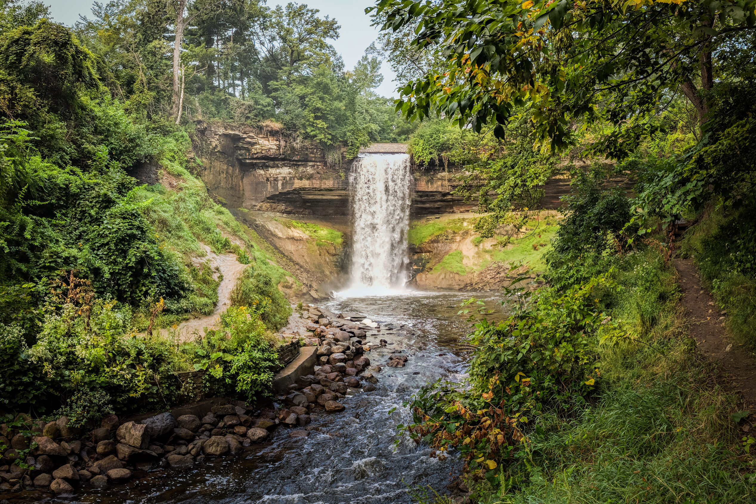
The word “Mini Haha,” meaning “curling water” or “the waterfall” comes from the Dakota. The creek itself they called “Wakpa Cistinna,” meaning “little river.” Other Dakota names for water bodies in the area included Bde Maka Ska (White Earth Lake) for Lake Calhoun, Mde Unma (Other Lake) for Lake Harriet, Wita Tomna (Four Islands Lake) for Lake of the Isles and Minne Washta (Good Water) for Lake Minnewashta.
In the mid 1800’s the Dakota Mdewakanton village Reyataotonwe (Inland Village) was located on the southwest shore of Lake Calhoun. The band’s chief was named Cloud Man, or Ma-hpi-ya-wi-ca-sta (Man of the Sky). Gideon and Samuel Pond set up a mission near the village in 1834 and taught the villagers to use European farming methods. In 1839, Chief Cloud Man and his band moved to Oak Grove (in present day Bloomington) to avoid conflict with the Ojibwe from the north and east. Another band camped annually on the peninsula between present day Gray’s Bay and Wayzata Bay to harvest wild rice. Chief Shakopee and his band camped on the site of present day Wayzata.
In 1822 a pair of 17-year-olds at Fort Snelling military base became the first Europeans to record a trip to Lake Minnetonka. The two boys and two other soldiers canoed for two days and 22 miles up Minnehaha Creek to Lake Minnetonka. They camped on Big Island and returned to the fort the next day. Though Joe Brown built the first cabin in the watershed on the shores of Lake Minnetonka in 1826, he abandoned it a few years later and for the next 30 years, few Europeans ventured up the creek (then referred to as Brown’s Creek). The Dakota successfully kept the presence of their sacred Lake Minnetonka a relative secret from mapmakers. As late as 1850, government maps failed to show the lake.
Europeans began settling west of the Mississippi in the mid 1800’s and many of them were attracted to the powerful Minnehaha Creek and picturesque Lake Minnetonka. Settlers could claim 160 acres apiece at a low government price as long as they built and occupied a house and fenced and cultivated land right away. By 1860 the entire watershed had been claimed, most of the forest had been logged, and most of the prairie plowed. The communities around the area’s abundant water resources continued to grow, setting the stage for the boom of the Twin Cities metro area at the turn of the 20th Century.