
In the 1950’s, Minnesota’s urban landscape was changing quickly. Populations were booming and cities were racing to develop land and expand their tax bases, frequently draining wetlands to reclaim buildable area.
This draining of wetlands, combined with more hard surfaces (roads, parking lots, roofs) where open space used to be, caused rainwater that used to soak into the ground to run off the landscape. As a result, downstream communities faced new and serious flooding issues. Responding to these problems was complicated because most cities’ boundaries were drawn without regard to where water flows, and they managed water independently of each other despite their shared hydrological link.
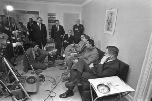
These issues, in addition to court battles over stream rights and drainage problems in the Red River Valley and other water-related concerns, led to the passage of the Minnesota Watershed Act by the Minnesota Legislature in 1955. This novel idea established a special-purpose unit of local government to manage water within a watershed’s hydrological boundary. Citizens could petition for the establishment of a watershed district to manage water on a watershed-wide scale. In the mid-1960’s, communities along the flood-prone Minnehaha Creek were feeling the effects of landscape change. Following devastating flooding in the spring of 1966 they petitioned the Minnesota Board of Water and Soil Resources to form the Minnehaha Creek Watershed District (MCWD).
The first order of business for the newly-formed organization was managing how Lake Minnetonka drained into Minnehaha Creek. There had been some kind of fixed structure restricting the flow of water from the lake to the creek since the mid-1800s, but none managed the discharge. Water levels fluctuated at the mercy of Mother Nature, to the chagrin of people who lived along the lake and creek.
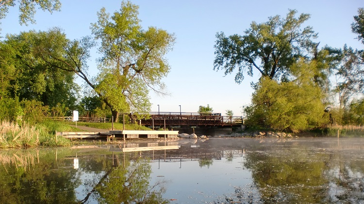
Creating an adjustable dam at the Gray’s Bay outlet to Minnehaha Creek, and a plan to guide its operation, was a complicated task. It took nearly ten years to develop an operating plan that was acceptable to the many communities and organizations that were involved in the process. A new adjustable dam was constructed in 1979. It was updated in 2006 to include a viewing/fishing deck and to connect it to a trail being built by the City of Minnetonka. The shoreline was restored and signage was installed.
Throughout the years, the Gray’s Bay Dam has been an effective tool in preventing flooding. Authorized by a permit from the Minnesota Department of Natural Resources, the MCWD’s management of the dam is guided by several factors in the operating plan – current water levels on the lake and creek, recent and projected rainfall, time of year and if the lake is on track to be low enough before ice-in to prevent flooding in the spring. The MCWD is also using the latest technology to maximize the dam’s effectiveness. Partnerships with the National Weather Service, U.S. Geological Survey and Hennepin County Emergency Management have enhanced our ability to anticipate the impact of weather events so we can be proactive in managing water levels.