
During this period, MCWD established data-driven project planning. It completed its first major project at the Gray’s Bay Headwaters Control Structure and continued to build its technical understanding of the watershed. Keeping a primary focus on flood mitigation, the MCWD also integrated water quality into a second more comprehensive water resources management plan. This period also saw a significant expansion of the reach of the District’s regulatory program and a related increase in enforcement efforts.
This article is excerpted from MCWD’s Historic Insights and Principles of Success publication, compiled by its Board of Managers and staff as part of a process to evaluate key events over time, extract strategic insights, and document learnings that could be carried forward to guide the future success of the organization.
Precipitation Cycles
This twelve-year period saw major swings in precipitation in the watershed. Higher than normal precipitation in the early 1980s prompted ongoing concerns about flooding along Minnehaha Creek. In May 1986, Lake Minnetonka elevation was 930.4, and the Creek was flowing at 285 cubic feet per second, overtopping the fixed crest portion of the dam and overflowing the Creek banks in many places. The District worked extensively during this time with municipalities on floodplain policy. The District found the state floodplain standards inadequate, and urged municipalities to adopt more stringent floodplain ordinances to prohibit filling in the floodplain. The District adopted a “High Water Conditions Policy Statement” in September 1980 in conjunction with its operating plan for the Grays Bay dam and control structure. Many of the public comments on the operating plan in the early 1980s emphasized concerns with creek flooding. The District considered adopting a canoe policy to warn the public of dangerous Creek flow conditions. The District embraced a request from the Minneapolis Park & Recreation Board to cooperate in a hydraulic study of Minnehaha Creek.
By November 1986, the level of Lake Minnetonka had subsided to 928.45. Notwithstanding a major storm and flooding event in July 1987, the overall precipitation trend declined, and the Grays Bay control structure remained closed from the Fall of 1986 to June 25, 1991. The level of Lake Minnetonka decreased to as low as 925.48 in December 1989. These lower lake levels prompted intensive interest in dredging Lake Minnetonka for navigational access, and the MCWD entered a period of more intensive regulation and enforcement activities to protect the lake as noted more fully below.
More Comprehensive Water Resource Plan
In 1982, the Minnesota Legislature adopted the Metropolitan Surface Water Management Act, which required all parts of the seven county metropolitan areas to be within an established watershed management organization and required all metro watersheds to complete comprehensive water resources management plans every ten years. The MCWD invested significant time with the Minnesota Association of Watershed Districts to develop standards for this planning process. The District also engaged in a multi-year planning effort to update its plan. Beyond its regular hydrologic monitoring program begun with the District’s inception in 1967, the MCWD invested considerable resources in developing its first computerized model to simulate the hydrologic characteristics of the entire watershed, which it completed in 1986. This model, along with water quality study of Lake Minnetonka formed the technical basis of the District’s comprehensive water resources management plan, a draft of which was completed in 1987. The MCWD had also spent several years developing its policies and updating its rules as a part of this planning process.
A quite lengthy period of plan review ensued after the initial distribution of the MCWD’s draft plan in 1987. The District spent several years unsuccessfully seeking a cooperative agreement with Hennepin County for the financing of the MCWD’s capital improvement projects. Several municipalities within the watershed registered comments of caution and concern with the District’s process of ordering capital projects, seeking assurance of opportunities for city input. Ultimately, these concerns delayed the approval of the MCWD’s plan by the Board of Water and Soil Resources until 1992.
Major Projects
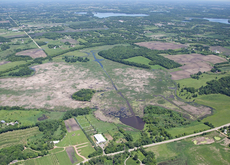
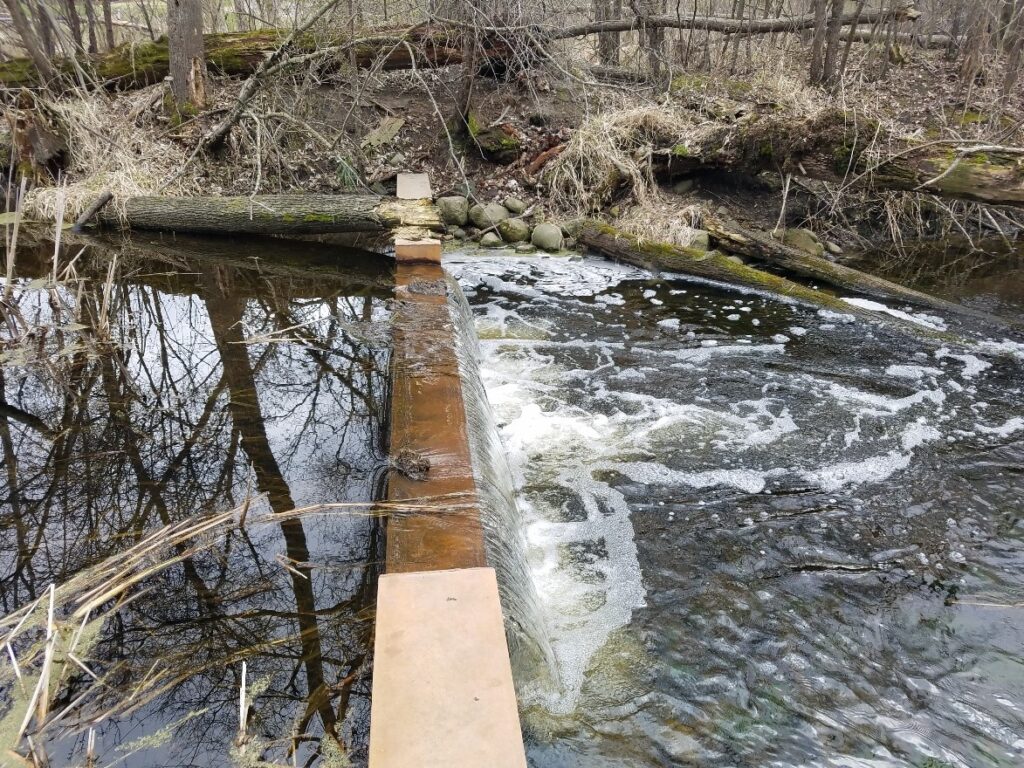
The MCWD successfully completed projects identified in its initial plan, the Gray’s Bay outlet structure and Creek recreational improvements, and the Painter Creek Upper Watershed Retention Project. The Grays Bay project was completed in 1980, and the Department of Natural Resources approved its operating plan in March 1980. This project had always been part of a package with smaller projects to improve recreational access to Minnehaha Creek, and these smaller projects were also complete by 1980.
The Gray’s Bay outlet structure received regular ongoing attention, as the District made small physical adjustments with staff gauges and consideration of fish and weed barriers in 1981. The District entered into an agreement with the City of Minnetonka to assist in maintenance of the structure, but declined the City’s request to augment Creek flow for its summer festival. Ongoing hearings to update the operating plan reflected creek resident and some legislative concern with balancing upstream and downstream interests. The District also determined that generally it is not feasible to operate an open channel discharge during winter months, and devoted technical study to maintaining base flow of the Creek in summer months.
MCWD’s second major capital improvement project was the Painter Creek Upper Watershed Retention Project. The Lake Minnetonka Conservation District petitioned for this project. The product of multiple years of feasibility study, planning and design, the project involved construction of various flow control devices and channel improvements to slow runoff to Lake Minnetonka and improve water quality. The District made extensive use of a project advisory committee to build community understanding and provide process advice for the project. The Board of Managers approved the preliminary engineering report for the project in May 1983, and after a public hearing held at the Orono High School auditorium on September 29, 1983, formally ordered the project. Detailed aerial photography and topographic mapping ensued in 1984 to assist in final project design and identification of easements required on 25 parcels. By December 1984, the Board awarded the construction contract, and commenced eminent domain proceedings to acquire the easements. Ultimately 21 of the easements were acquired voluntarily, and four acquired through the eminent domain process.
A third major capital improvement project to improve water quality in Long Lake commenced the diagnostic feasibility study process in 1988.100 Discussion of concerns for Long Lake water quality led to the District seeking a Clean Water Partnership grant from the Minnesota Pollution Control Agency to fund this initial diagnostic study.
Other Projects
MCWD annually funded small projects requested by cities through its maintenance and repair fund. These projects typically involved removal of obstructions such as fallen trees from the Creek, sediment removal from storm sewer outfalls, or aquatic weed harvesting. The District also spent several years working with local partners on a variety of localized flooding problems, including storm drainage improvements at Galpin Lake, channel improvements to the Creek at Highway 100 in cooperation with MnDOT and the City of Edina, dredging of the Creek at 44th Street in Edina, and work with the City of Shorewood to address flooding problems at Glen Road and County Road 19.
Regulatory Program Expansion
MCWD devoted substantial resources to the development of its regulatory program during this period. From approval of 113 permits in 1980 to a high of 206 permits in 1986, most of these permit applications related to development activity in the Lake Minnetonka area. Some projects arose in response to the precipitation cycle changes, with repair of shorelines in response to erosion or increased demand for dredging projects to achieve navigational access on Lake Minnetonka during the low water years of 1986-91. At its June 15, 1989 meeting, for example, the Board of Managers approved 11 permits for dredging projects alone.
Based on the technical information that the littoral zone of a lake is vital to the lake’s ecology, the MCWD joined with the DNR to protect the lake bottom from over-dredging, and protect the lake’s floodplain from fill of dredging spoils. As more marinas and other boating enthusiasts grew concerned with low lake levels and navigation access, some operators decided to challenge the MCWD’s enforcement authority. One example came from a group of homeowners on Libbs Lake (a small waterbody connected by a narrow channel to Lake Minnetonka) who in 1989 obtained a permit to dredge approximately 2,000 cubic yards from the lake bottom to improve their access to Lake Minnetonka, but in fact were found to have dredged 9,000 cubic yards and left much of the spoils in the floodplain. The District devoted multiple meetings over a period of two years with the homeowners and the DNR. Some of the homeowners filed a district court action to appeal the Board’s remedial order, and ultimately the parties achieved a settlement that required removal of all of the dredging spoils from the floodplain and payment of the MCWD’s enforcement costs.
In July 1989, Gayles Marina sought an amendment of its MCWD dredging permit to allow the marina to dredge to an elevation of 921.6 feet instead of
924.0 feet as allowed by the District rules. The marina contended that half of its boat slips were unusable under the existing conditions, and the deeper elevation was necessary to meet the needs of its dredging barge. When the MCWD stood by the original permit decision, Gayles Marina sought judicial review in district court. The district court declined, concluding that only decisions about watershed district projects were appealable to district court. The marina appealed to the Minnesota Court of Appeals, which held that the marina could obtain an accelerated jury trial to review the Board of Managers decision de novo. The Minnesota Supreme Court affirmed the court of appeals. The MCWD then successfully petitioned the legislature to revise the statute to provide that watershed district permit decisions are reviewed in district court, but through a declaratory judgment action based on the record made before the board of managers. (The legislature did not adopt another MCWD request to provide authority to issue civil fines or administrative penalty orders for watershed district rule violations.)
During this time the MCWD addressed multiple dredging violations and devoted considerable effort to updating its rules and adopting a requirement that dredging contractors who work on “priority” lakes in the watershed be licensed by the District. The Board of Managers adopted this rule to address a number of unpermitted and unfeasible dredging projects that threatened the lake environment. The District also updated its dredging standards and modified its rule regulating installation of sand blankets.
The MCWD’s regulatory program also prompted engagement with the Minnesota Department of Transportation during this time, with President James Spensley taking the lead in commenting on MnDOT’s plans for expansion of I-35W in south Minneapolis.
Other Policy Concerns
The MCWD engaged in a variety of other policy issues beyond its regulatory program during this period. In addition to intensive flood study and promotion of stronger floodplain ordinances, the District commented extensively to promote the ultimate closure of the Maple Plain sewage treatment plan, which was the last sewage discharge to Lake Minnetonka. Again through President Spensley’s engagement, the MCWD weighed in with ongoing comments about the discharge from the Reilly Tar remedial gradient wells in St. Louis Park, urging that the wells discharge to the Minneapolis lakes. In 1991, managers participated extensively in the development of a new comprehensive management plan for the Lake Minnetonka Conservation District, providing for changes in the LMCD board’s composition, funding sources for LMCD projects, and increased enforcement to address water quality and safety issues. The District also promoted watershed education and stewardship through annual Minnehaha Creek clean up days sponsored by the Izaac Walton League and Boy Scouts.
Governance
Barbara Gudmundson (Ph.D. in Botany and Water Resources) became the first woman to serve on the MCWD Board of Managers, serving one term from 1980 – 1983. The MCWD Board of Managers expanded from five to seven managers in late 1983 through the District’s petition to the Minnesota Board of Water Resources. The two additional managers were for appointment from Hennepin County, and James Spensley from Minneapolis and James McWethy of Edina took their seats on the board in the spring of 1984. Manager Spensley contested and prevailed to be elected the board president in 1988. As Board President, Manager Spensley represented the District in many regulatory and policy discussions.
During this period, Mike Panzer of Wenck assumed the role of District Engineer [in 1992], and Louis Smith from the Popham Haik firm assumed the role of District counsel in 1987. The engineer and attorney continued to serve as the sole staff support for the District.
Continue reading the MCWD history series: